As climate change continues to threaten communities with extreme weather events and sea level rise, innovative approaches to increasing resilience are a critical strategy to mitigate the potential damage. Norfolk, Virginia’s comprehensive climate-informed zoning reform is one of the first to use climate considerations to guide future development—and despite concerns that it could have a negative economic impact on residents, a study from Smart Growth America and the Lincoln Institute of Land Policy shows that these concerns have thus far been largely unfounded. Examples from Norfolk and other cities in the U.S. show the potential for zoning reform to be a powerful tool for protecting communities from climate change.
How Climate-Informed Zoning Works
Zoning is the main way that cities can control where development occurs and what this development looks like. A city’s zoning code regulates the built environment, outlining allowed building uses, densities, sizes, and other associated characteristics. As a result, incorporating climate considerations into the zoning code can help cities ensure that their communities are climate-ready. Climate-informed zoning considers the effects of climate change in the way it guides future development, such as by restricting buildings in areas vulnerable to sea level rise, flooding, wildfires, or other climate hazards.
Norfolk, VA and Climate-Informed Zoning

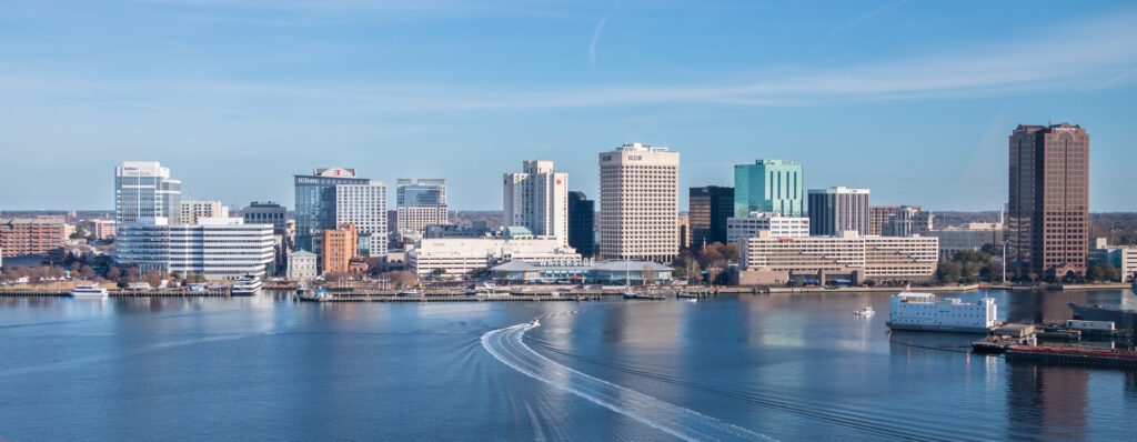
Located in southeastern Virginia, the city of Norfolk is low-lying and exposed to the coast on three sides. Residents regularly experience sunny-day flooding, and climate change will only continue to increase the city’s exposure to sea level rise, storm surge, and tidal flooding. In recognition of these threats, the city launched the Vision 2100 plan in 2016 to guide future development away from flood-prone areas. This plan divided the city into four, color-coded vision areas, each with different strategies aimed at climate change adaptation. The red and yellow vision areas were deemed to have the highest risk of flooding from sea level rise, while the green and purple vision areas have lower risk. Vision 2100 aims to protect the existing assets in the red zone, which includes the city’s downtown, while also directing future development towards the green zone.
By labeling certain areas of the city as flood-prone zones and discouraging further development there, the Vision 2100 plan risked causing economic decline. Smart Growth America and the Lincoln Institute of Land Policy partnered to conduct an analysis of the economic impact of the early implementation of the plan as well as the subsequent creation of overlay zones where further restrictions apply. The analysis compared building permit applications and residential home sale prices in the years prior to the zoning reform to the years since its establishment.
The study found that Norfolk’s zoning reform increased new building permits in purple and green zones (low-risk areas) compared to yellow zones (high-risk areas), in line with the city’s goals of development outside flood-prone areas. The study also found that the zoning reforms did not result in any significant changes in home sale prices, although some slight changes across the zones were noted that may require further study. At least initially, Norfolk’s Vision 2100 plan did not have a negative economic impact on residents via housing values.
Read our report on the fiscal impact of Norfolk’s climate-informed zoning initiatives
Climate-Informed Zoning Across the U.S.
While Norfolk’s climate-informed zoning reform was especially comprehensive, many other cities across the U.S. have used their zoning codes to implement innovative approaches for addressing the threats that climate change brings forth.
In Boston, Massachusetts, where much of the city lies on reclaimed land vulnerable to flooding, the Climate Ready Boston initiative works to develop resilience projects to address both coastal and inland flooding as well as mitigate extreme temperatures. As part of this initiative, a Coastal Flood Resilience Overlay District (CFROD) was adopted into the zoning code in 2021, protecting areas deemed especially likely to flood. In the CFROD, specific guidelines on development aim to reduce greenhouse gas emissions, adapt to sea level rise, and create more public spaces. This is enforced through zoning regulations that limit further residential development and require a stringent review process for new developments.
In Charleston, South Carolina, where sea level rise predictions indicate the city could be underwater by 2050, the 2023 Flooding & Sea Level Rise Strategy established an Upper Peninsula Zoning District. In this district, which is less vulnerable to flooding, new development can receive density and height bonuses, which encourages developers to invest in areas that may see less flooding. The city also initiated the Bluebelt Program, which funds flood mitigation projects, especially those in areas with a history of flooding and those adjacent to schools and other civic facilities. The program seeks to restore some of the city’s natural floodplains to reduce the risk of flooding.
In Stonington, Connecticut, where nearly half of all properties face a significant risk of flooding within 50 years, the 2017 Stonington Coastal Resilience Plan limits new development within flood-prone areas, while also offering acquisition and buyouts for residents in these areas. The town also uses unique financing and taxation programs to incentivize future development outside of areas likely to flood and to fund coastal resiliency efforts.
In New Orleans, Louisiana, where extreme weather events like tropical storms and hurricanes already devastate the low-lying city, part of the Comprehensive Zoning Ordinance was replaced with the Stormwater Code in 2018. These regulations focus on using natural resources to mitigate flooding risk, including through nature-based strategies outlined in the Green Infrastructure Toolkit.
Similarly, in Washington, D.C., zoning regulations incentivize the use of natural elements as tools for flood mitigation. The District regulates green area ratios in certain flood-prone districts, with developments scoring higher for incorporating green infrastructure approaches to flood mitigation (such as shrubbery, trees, or pervious surfaces).

Climate-Informed Zoning: Looking Ahead
As communities across the U.S. continue to face the effects of climate change, the potential for zoning to help cities adapt to these threats will only become more clear. Local governments currently implementing creative and inventive new strategies to address these challenges may lead the way, especially as ongoing research clarifies and strengthens some of these efforts. Comprehensive zoning overhauls such as Norfolk’s or more piecemeal approaches as in other cities may both have a role to play.
Read the full report on the fiscal impact of Norfolk’s climate-informed zoning initiatives