We are just around the corner from releasing Dangerous by Design, our national report that explores why the number of people struck and killed while walking is continuing a decade-long increase and how we continue to design and build streets that are incredibly dangerous for people walking. We want to see the streets near you where walking is unpleasant, inconvenient or downright hazardous to your health.
If numbers can’t show Congress that this is a problem, maybe pictures can help.
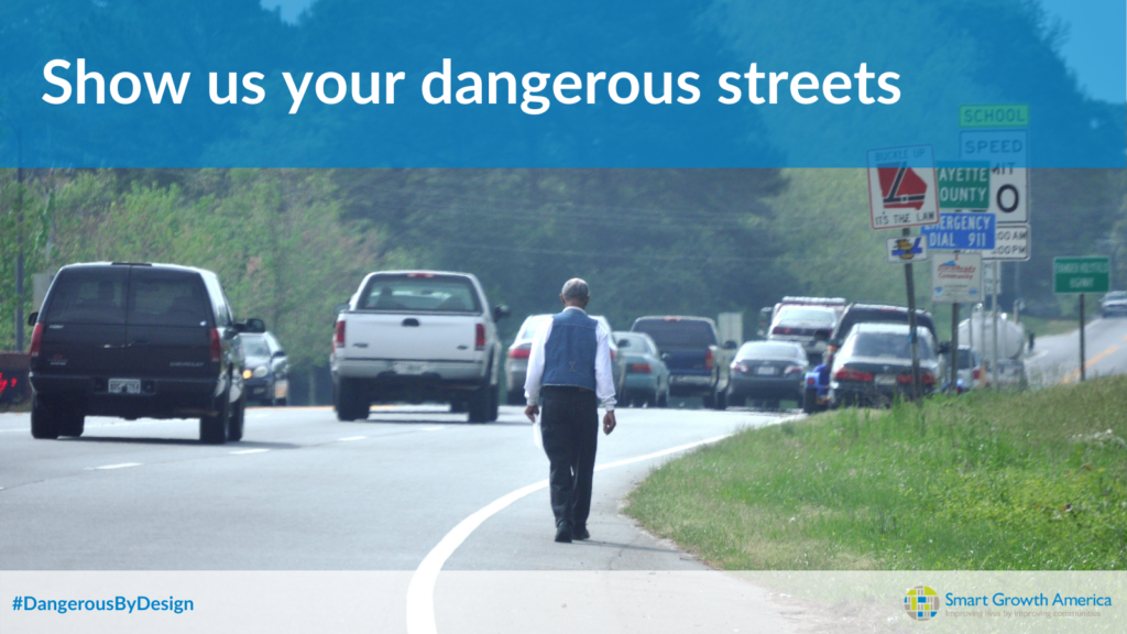
Send us your photos of dangerous, unsafe and poorly planned streets out there across America. We want to incorporate some of them into this year’s report.
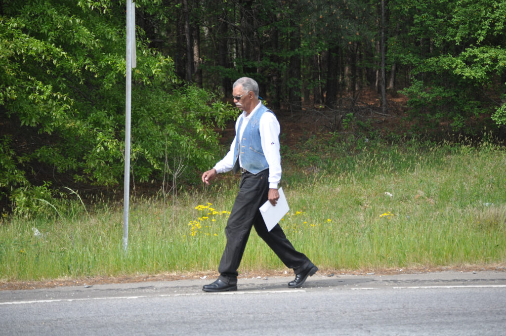
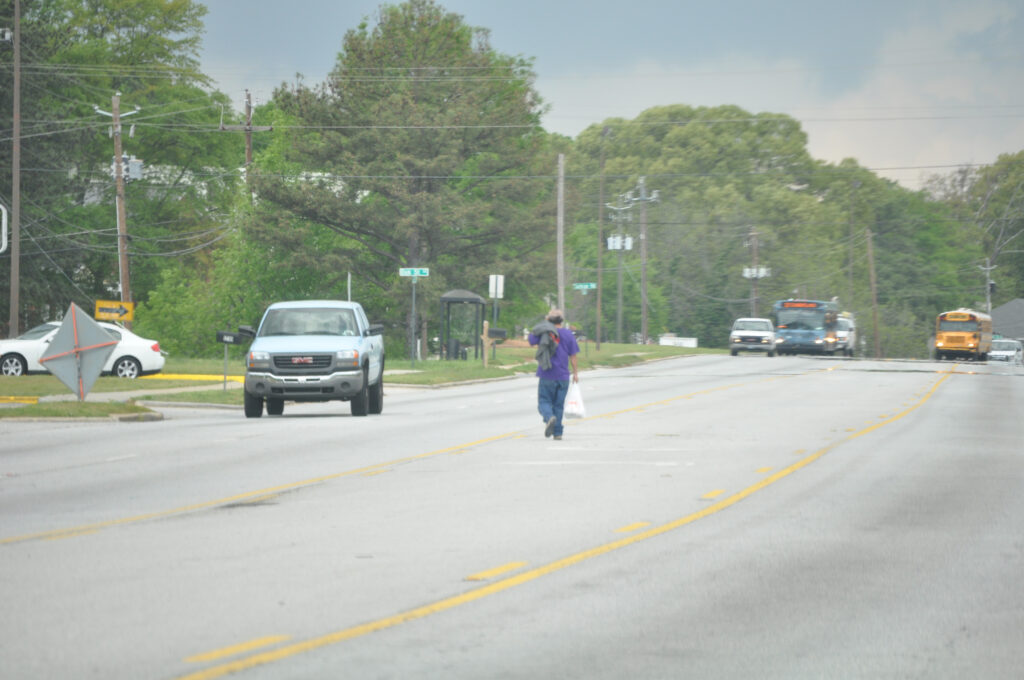
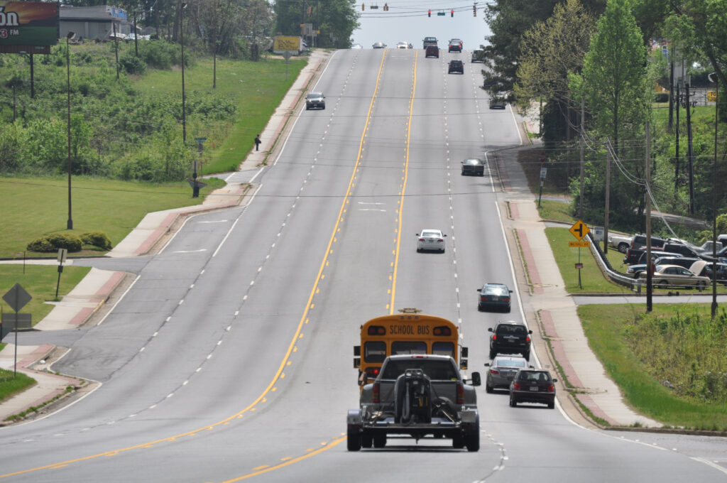
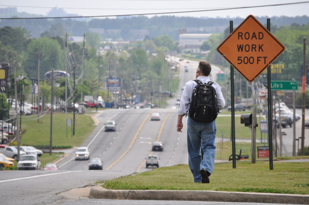
We want to see what streets look like out there for people trying to walk. We want to see the missing crosswalks, the 1/2-mile treks to the nearest crosswalk along a 50 mph highway, and dangerous roads designed for speeding traffic rather than safe walking. A large majority of the more than 100,000 people killed while walking since 2000 occurred on roads fitting these descriptions.
We all have that spot: where you’ve almost been hit, where you have to search for a crosswalk, where the sidewalk literally ends.
How to send in your photos:
- Upload them with the form at the bottom of this page
- Tag us on Twitter using @SmartGrowthUSA and we’ll credit your Twitter handle
Here some of the things we’d love to see:
- Dangerously designed streets. Wide lanes, streets designed for speed over safety, missing sidewalks, no crosswalks, crosswalks far apart, bus stops with no ADA ramps. View this old T4America Flickr set to get a good idea of what we’re looking for.
- This story is one of inequities. An advocate from Jackson, Mississippi has provided numerous photos of people in wheelchairs or using assistive devices, but we want to especially highlight this part of the story and the disparate impact on people of color and those walking in lower-income neighborhoods.
- People. This story isn’t about infrastructure, it’s about the people who use it
- Before / afters of safety projects that made dangerous places safer. We want to show how danger can be addressed through safer designs and proven safety countermeasures.
- The higher the resolution, the more likely we’ll be able to use it. (At least 1200 px on the long side)
- Tell us where! We want to know where these streets are located.
- Include your preferred name for credit
Poorly designed streets—often built or designed with federal dollars—endanger everyone. Too many people are walking in places where they’re likely to become the next statistic because of streets that are dangerous by design. Help us paint a compelling picture of why Our current approach to addressing these deaths needs to be reconsidered or dropped altogether,” as we will say in Dangerous by Design 2021, “because it is not working.”
Your photos will help.
Read some of our preliminary thoughts about Dangerous by Design 2021, and how we’re stuck in a time loop where we say the same thing every two years.
Upload your photos of dangerous streets in the form below. By submitting your photos, you are giving permission for Smart Growth America to share in our Dangerous by Design report and on social media channels.